Pyrenees, 2002
September 2002: I spent two weeks walking in the Pyrenees. I started from Cauterets, a short bus journey from Lourdes, and walked generally east to the end at the spa-town of Bagnères de Luchon.
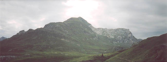
My first summit was the 2608 metre Pic des Sècres. The changeable weather meant that while most of the ascent in the morning was cloudy, and the early afternoon sunny, when I was actually on the summit it rained through the mist.
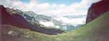
This picture shows the view west from the slopes of the Montagne de Sècres as I descended.
In the late afternoon I was again drenched in a lengthy thunder-storm.
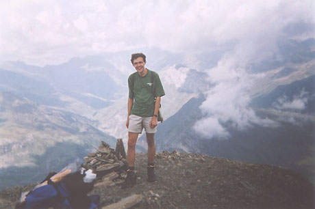
The
photo at the top of this page shows me on the next summit, Piméné (2801 metres), above the popular village of Gavarnie. Yes, that's my lunch fixed to the outside of my rucksack! Thanks to the pair of British guys I met up there, one of whom took the photograph!
It was a relatively easy walk up the path from Gavarnie. OK, so it involved over 1400 metres of ascent, but that's the sort of thing I came to expect on a daily basis in the Pyrenees... the morning was sunny, and the path took me first through the forest on the lower levels before heading out on to the open slopes and eventually on to the rocky summit-ridge.
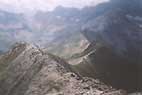

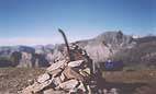
Two views from the summit of Piméné.
I came down from Piméné just in time. Not so long after I left the ridge the rain and thunder started. It cleared up after an hour or so, but I was glad to get to the Cabane de Groutte a little time later.
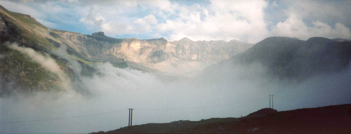
'Cabanes' are simple huts (like bothies in Scotland) used mainly by shepherds or walkers. This one was big enough for perhaps 4-6 people at a squeeze. It was basically a bare stone building with a sleeping platform inside... not much else... but it was dry and sheltered. The weather changes quickly; when I arrived it was sunny, but I soon saw the first swirls of mist coming from the valley floor. Within just a couple of minutes, literally as I watched, the mist filled the entire valley and concealed the view completely. Here's a photo taken from outside the hut as the mist climbs higher.
I stayed one night in the cabane. No-one else was there. This picture of it was taken next morning, when, unusually for this time of day, everything was enveloped in the fog.
By the time I stopped for lunch, I had ascended well out of the mist. (I had spent the entire morning going up some ridiculous height, and I had still only made it up to the pass necessary to cross into the next valley.) As happens so often here, ridges create entirely independent weather systems... you can see the north side has plenty of sun.
After an afternoon in which the rain came down profusely, I arrived at the Refuge de Barroude, a lone building way up by a few lakes amidst the ridges.
The next morning was probably the finest of the two weeks. The ground was frosty; the only clouds were way below, in the valleys to the north. I was so high up already that reaching the Port de Barroude col took only minutes. The photo looks back north from where I had come, from the col (which is directly on the national boundary).
The Summit of Pic de Barrosa brought equally amazing views; and was also very quick to reach.
From here I headed back towards the col, but then veered off and down. And down, and down. All the way into the Spanish village of Bielsa, where I stocked up on some food, and some unsatisfactory maps. Having descended 1500 metres, I found myself having to reascend at least 1000 metres simply to find a suitable camping place. The one I eventually found was hardly what you'd really call suitable, between a road, a stream and a hydro-electric station up just above the forest line. But given that I was so short on time, I ended up running around (in shorts) through nettles and long grass desperately trying to simultaneously pitch my tent, unpack, get water, cook dinner, and eat it, before it got too dark to see anything, I really didn't have much choice.
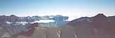
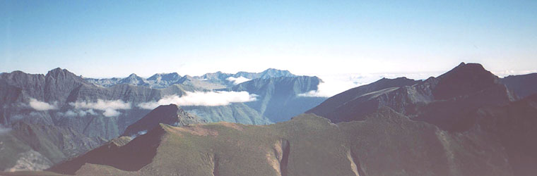
The next day I did Pic de Batoua. At 3034 metres, this was the highest summit I reached. The view you see here was taken a little earlier in the day; by the time I reached the top, one side of the summit ridge was under attack from the rain and wind. The sheltered side gave a little bit of view, in between the clouds - but nothing spectacular. The summit ridge was really very rocky, and in places more of a scramble than a walk.
A view from the col "Couret d'Esquierry".

Looking back south-west as I headed up to the Pic de Céciré (2403 metres)
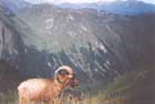
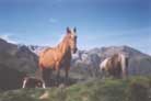
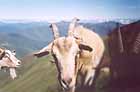
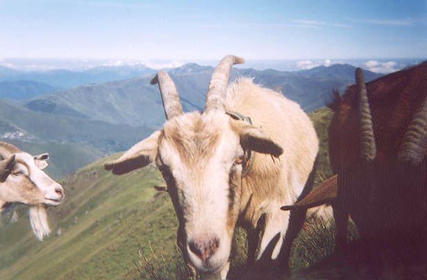
I found this selection of creatures on the way to Pic de Céciré. They're all way above 2000 metres, and so probably at least a thousand metres above any of the surrounding farms.
Level with the cloudline, at somewhere around 2000 metres, north of Bagnères de Luchon. By this time it was well into the afternoon. Within an hour or two, the clouds spread across east to where I was, and I descended through the mist for an hour.
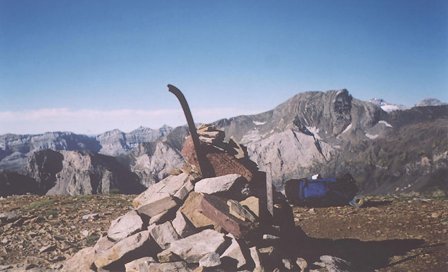
This border post (and trigonometrical station?), on the boundary between France (F) and Spain (E) is situated at the summit of the Pic de Bacanère. Its height of 2193 metres doesn't sound so much in comparison with some of the other tops I reached. But since I started ascending earlier in the day from Luchon, at about 620 metres, I think it has some merit of its own!


